Drone Video Surveillance
About
OBJECTIVES
Development. Design and develop a web application that communicates with the embedded systems of UAVs on a mission and allows end users to use live video streaming from onboard cameras for surveillance and defense purposes.
Research. Aiming to improve the autonomy of UAVs systems, apply the recent advances in computational processing and computer vision algorithms to enhance the autonomy of aerial drones in the GPS-challenging or even GPS-denied environments.

CHALLENGE
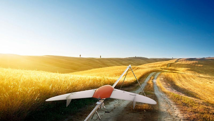
Our Client is an engineering company specializing in UAV aircrafts and relevant systems’ software based in the United Kingdom. The company delivers UAV solutions for tracking and surveillance missions as well as special-purpose aircrafts for police and defense.
We have accomplished a number of projects for the Client, including the configuration of communication workflows for UAVs’ embedded systems and ground stations; delivering live video streams from drones’ onboard cameras in real time to end-user desktops; cutting-edge research of mathematical algorithms for specific missions.
We are currently investigating SLAM approach, odometry, and machine learning algorithms for GPS-denied missions and obstacles avoidance purposes.

SOLUTION
A few years ago, we started by compiling the hardware elements for the Client’s drone missions and were also supporting their electronic system’s components and the communication workflows of the UAVs’ embedded systems with their base control stations. Now our research and development projects include SLAM approach for UAV systems that can operate in GPS-denied environments.
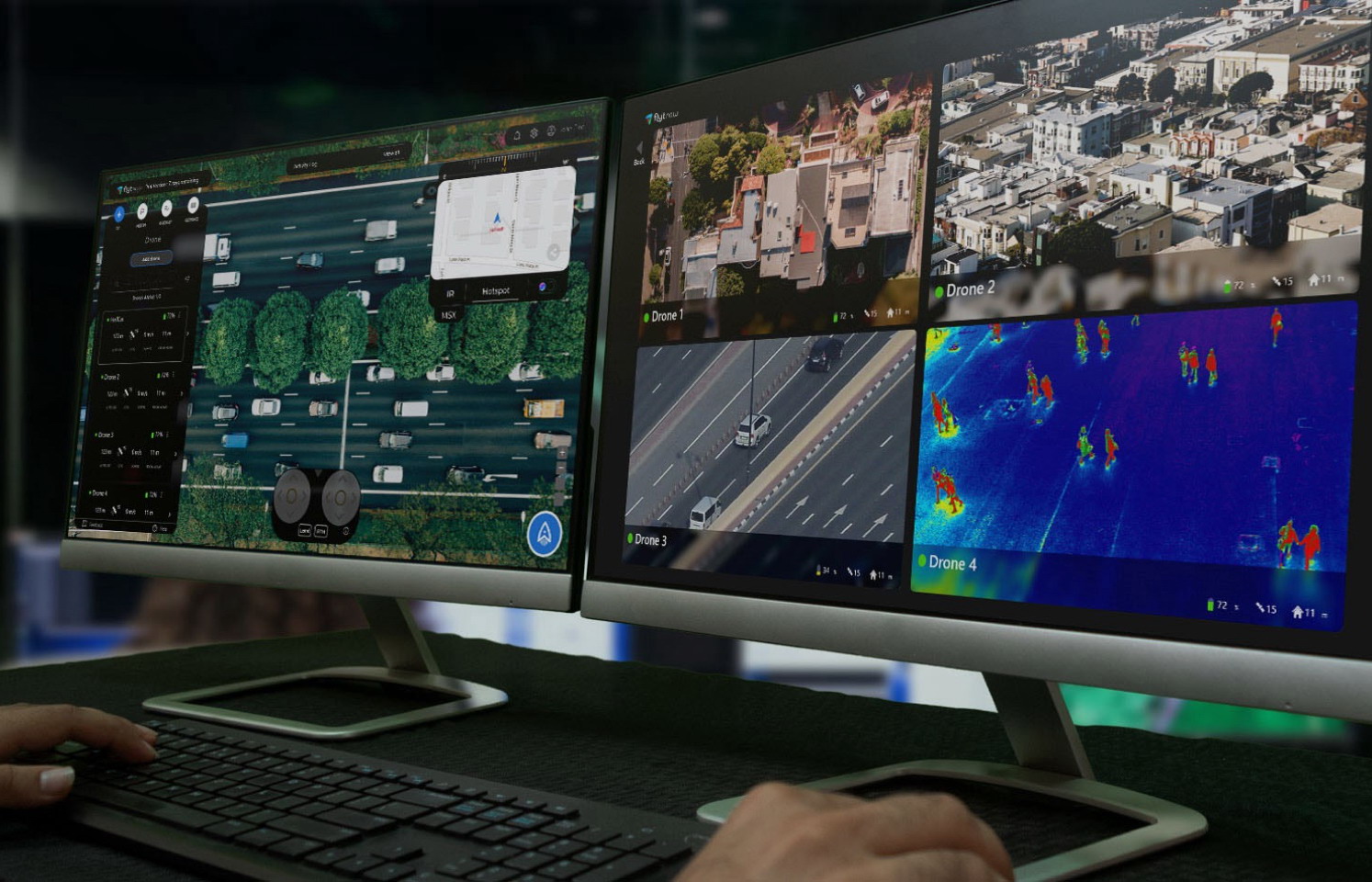
During the course of our cooperation with the Client, one of our big projects was to develop a web interface for the purposes of field-to-cloud streaming and its application by end users. To configure the real-time communication workflows of the embedded UAVs’ systems and restream them from the ground control station to the designed web application was another task we were working on. Delivering live video from field-missions of the Client’s UAVs to anywhere in the world became possible due to our collaboration on the project.
As part of our current R&D work, we investigate SLAM approach and odometry algorithms to solve the problem of GPS-challenging environments. To do so, we present our Client’s in-house team with extensive sets of computer simulations to validate the investigated approaches. The simulation results show that our proposed system algorithm is able to provide a good position and orientation estimation of the aerial vehicles flying in GPS-denied environments; namely, applying visual odometry and machine learning for obstacles avoidance.
Technology choice
- Backend development – C++, Qt
- Frontend development –Symphony
- iOS development – Object-C
Team and Duration
- 1 mechanical engineer
- 1 electronic engineer
- 2 backend programmers
- 1 frontend programmer
- 1 PM
- 1 QA
- 3 years

RESULTS
As a result of our cooperation with the Client, their end users – who happen to be police and defense professionals – can accomplish a couple of sophisticated missions now:
- View video streams from drones in real time on their screens / desktops
- Coordinate and command mission units from anywhere
- Have as many commanders as needed to view the video simultaneously
The Client’s autonomous, sensing auto pilot system is capable to perform an all-around visual surveillance missions, orientation and collision avoidance.